
2026 Top Firefighting Drones for Global Buyers?

Choosing among the 2026 top Firefighting Drones requires more than comparing camera resolution or flight time. Buyers need equipment that performs beside smoke, heat, wind, and unstable structures. A drone may look impressive in a showroom, yet fail when ash covers its sensors. That difference matters.

Chief Charles Werner, a respected public-safety technology adviser, has often emphasized this principle: “Drones are not a replacement for firefighters; they are a safety tool.” His view remains practical. The best systems support incident commanders with thermal images, live mapping, loudspeakers, and safer aerial observation. They do not replace trained crews, risk assessment, or disciplined communication.

This guide examines Firefighting Drones for municipal departments, industrial response teams, airport authorities, and global buyers. It considers thermal performance, wind resistance, battery logistics, night operations, data security, maintenance, training, and service support. Regulatory approval also matters, because operating requirements differ between countries and regions. Buyers should verify local aviation, privacy, radio, and emergency-response rules before deployment.

Real experience often exposes weaknesses that brochures hide. A drone with excellent endurance may require complicated battery management. A compact model may be easier to transport but less stable near tall buildings. No ranking is perfect. Conditions change quickly. Therefore, this overview weighs practical performance, not marketing claims alone. The strongest choice is the platform that crews can operate safely, maintain consistently, and trust during a difficult call.
2026 Top Firefighting Drones for Global Buyers?

What Are Firefighting Drones and How Do They Work?

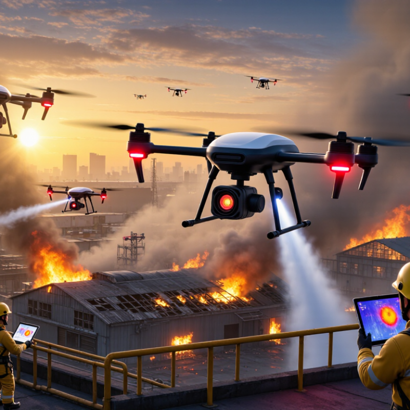
Firefighting drones are unmanned aircraft designed to support emergency crews, not replace them. They carry thermal cameras, visual cameras, air-quality sensors, and positioning systems. From above, a drone can reveal roof hotspots, blocked access roads, and changing smoke patterns. This aerial view helps incident commanders make safer decisions before sending people inside. Some aircraft also use loudspeakers, powerful lights, or compact water-delivery systems. Their value depends on the mission.

During an operation, a trained pilot launches from a safe area and follows an approved flight plan. The thermal camera detects heat differences, while the standard camera confirms what those signals mean. Live video reaches a control station through a secure communications link. Mapping software can mark temperature increases, trace fire boundaries, and store images for later review. If smoke thickens or wind shifts, the pilot can change altitude or withdraw quickly. Battery limits are real.

In field exercises, teams often learn that clear data matters more than dramatic footage. A drone may locate a hidden ember, but it cannot understand every structural risk. Smoke can deceive. Heat reflections, rain, and dense smoke may also mislead sensors. Reliable use requires trained operators, maintenance records, weather checks, and coordination with emergency authorities. Buyers should examine flight time, thermal accuracy, payload limits, data security, and technical support. The technology is improving, but no aircraft makes a difficult fire simple.

2026 Top Firefighting Drones for Global Buyers

What Are Firefighting Drones and How Do They Work?

Firefighting drones combine thermal imaging, visual cameras, GPS navigation and wireless control to locate hotspots, monitor fire spread and support emergency teams. The chart shows representative planning benchmarks: the U.S. Part 107 altitude and speed limits, a common multirotor endurance range, and a commonly specified thermal measurement ceiling. Actual performance depends on aircraft design, weather, payload, battery condition and local aviation regulations.

Regulatory reference: U.S. FAA Part 107 permits operations up to 400 ft above ground level and up to 100 mph for small unmanned aircraft, subject to applicable operating conditions.

Key Features to Compare in 2026 Firefighting Drones

2026 Top Firefighting Drones for Global Buyers?

Key Features to Compare in 2026 Firefighting Drones

A capable firefighting drone should deliver useful information before carrying water. Thermal imaging can reveal people, roof voids, and hidden hot spots through smoke. A stabilized optical camera adds detail during daylight inspections. Look for clear imagery, accurate temperature readings, and reliable performance in darkness.

Flight endurance needs careful reading. A drone rated for 30 minutes may fly far less with wind, heat, or a water payload. Compare useful flight time, battery replacement speed, and charging options at remote sites. Strong obstacle avoidance matters near towers, power lines, and damaged buildings. Yet sensors can struggle in thick smoke or poor weather. Human judgment remains essential.

Water delivery is another practical test. Check tank capacity, spray range, flow control, and the effect of payload weight on stability. An IP-rated airframe may resist dust and rain, but no rating guarantees safe operation beside intense flames. Secure communication, encrypted control links, and accurate positioning support safer missions. Local aviation approval and trained operators also matter. Automatic route planning saves time, though it may fail around changing smoke columns. Field trials should measure launch speed, image delay, battery temperature, and recovery after signal loss. Published specifications are useful, but real fire-ground data is more honest.

Top Firefighting Drone Types for Global Buyers

Top Firefighting Drone Types for Global Buyers

Thermal-imaging multirotor drones help crews locate flames through smoke, darkness, and unstable structures. Their vertical takeoff suits narrow streets, forests, and industrial sites. High-resolution cameras can map hot spots, roof damage, and trapped heat before crews enter. In practical deployments, stable hovering often matters more than maximum speed.

Tethered drones provide continuous aerial observation near command vehicles. Their powered cable supports long missions and reliable live video. Heavy-lift multirotors can carry lighting, speakers, sensors, or limited suppression equipment. They need stronger launch areas and careful payload checks. Fixed-wing drones cover large forests quickly, but they cannot hover over one burning building. That limitation is easy to underestimate.

Tips: Match the drone type to the mission, not the brochure. Check wind resistance, thermal accuracy, battery endurance, spare parts, pilot training, and local aviation rules. Ask for independent test data and documented maintenance procedures. Data storage also deserves attention, especially near homes or critical infrastructure. Some thermal readings look precise but change with distance, smoke, and reflective surfaces. Human confirmation remains essential. A drone may find the heat, but it cannot understand every risk. Start with realistic drills, then review failures honestly.arsuaq

Safety, Regulations, and Operating Requirements

2026 Top Firefighting Drones for Global Buyers?

Safety, Regulations, and Operating Requirements

Firefighting drones can map heat, smoke, and escape routes before crews enter dangerous areas. Buyers should assess the aircraft, training, and support system together. A high-resolution thermal camera helps identify hot spots behind walls or beneath roofing. Visibility matters. Smoke, wind, ash, and intense heat can reduce sensor accuracy and flight stability.

Operating rules differ by country and sometimes by region. Obtain approval from the relevant aviation authority before deployment. Check pilot certification, aircraft registration, remote identification, insurance, and restricted airspace requirements. Emergency exemptions may exist, but they are not automatic. Coordination with fire commanders, airports, police, and utility operators prevents conflicting flights. Privacy rules also apply when cameras capture homes, roads, or bystanders.

A practical operating plan should define launch zones, battery limits, weather thresholds, lost-link procedures, and emergency landing areas. Keep trained observers near the command post, not inside the hazard zone. Use clear radio phrases and record every flight, maintenance check, and battery cycle. Water-carrying systems require extra review because payload, pressure, and falling material create new risks. Conditions change quickly. Even experienced teams can overestimate battery endurance near smoke and strong updrafts. That gap deserves honest testing before a real incident. A controlled drill with local responders often reveals weaknesses that product demonstrations hide.

2026 Top Firefighting Drones for Global Buyers? – Safety, Regulations, and Operating Requirements
Drone Category Primary Firefighting Use Typical Flight Endurance Useful Payload or Sensor Package Typical Operating Range Key Safety Advantages Main Operating Limitations Important Regulatory Requirements Recommended Buyer Profile
Thermal Imaging Multirotor Hot-spot detection, victim location, roof inspection, perimeter monitoring, and post-fire assessment. Approximately 25–45 minutes per battery, depending on aircraft mass, weather, payload, and flight profile. Radiometric thermal camera, visible-light camera, spotlight, loudspeaker, and positioning system. Usually within 1–5 km of the launch point when operated under visual-line-of-sight procedures. Can provide rapid situational awareness without immediately exposing personnel to smoke, heat, unstable structures, or hazardous materials. Thermal cameras may be affected by reflective surfaces, hot smoke, steam, water spray, and heavy rain. Battery endurance decreases in cold or windy conditions. Operators generally need remote-pilot authorization, aircraft registration where required, pre-flight risk assessment, airspace approval, and visual-line-of-sight operation unless an exemption or specific authorization applies. Municipal fire services, industrial emergency teams, utility operators, and search-and-rescue organizations.
Heavy-Lift Multirotor Transporting small emergency supplies, communication equipment, lighting, rescue items, or specialized sensors to difficult-to-access areas. Approximately 15–35 minutes, strongly dependent on payload weight and battery configuration. Payload capacity commonly ranges from about 2–20 kg in this operational class; exact capacity must be verified from the aircraft’s approved documentation. Normally short to medium range because payload weight reduces endurance and reserve capacity. Can reduce the need for personnel to enter unstable terrain, contaminated areas, floodwater, or elevated structures. High mass and rotor energy increase the consequences of a loss of control. Payload release, suspended loads, and operation near people require additional risk controls. Many jurisdictions require additional operational approval for heavier aircraft, flights over people, payload dropping, or operations near emergency response zones. The aircraft must remain within its approved weight and balance limits. Specialized fire departments, disaster-response agencies, mines, ports, energy facilities, and large industrial sites.
Tethered Observation Drone Persistent overwatch of wildfire lines, industrial incidents, evacuation routes, hazardous-material zones, and large public-safety scenes. Several hours or longer when supplied continuously by a ground tether system; flight duration depends on generator or power-source capacity. Thermal camera, optical zoom camera, spotlight, communications relay, and scene-recording equipment. Commonly positioned within several hundred metres of the ground station, subject to tether length, terrain, and local authorization. Continuous power can reduce battery-change risk and maintain a stable observation point for incident commanders. The tether can create a snagging or entanglement hazard and may be affected by strong wind, cranes, trees, wires, or firefighting aircraft. Requires a controlled launch and recovery area, tether-management procedure, obstacle assessment, aviation deconfliction, and authorization for the intended airspace and operating height. Incident command teams, refineries, airports, power stations, ports, and fixed emergency-control locations.
Long-Endurance VTOL or Fixed-Wing System Wildfire mapping, smoke-front monitoring, broad-area damage assessment, and detection of changing fire boundaries. Approximately 60–180 minutes for many systems in this category; actual endurance varies with aircraft configuration and payload. Thermal and multispectral cameras, mapping camera, automatic identification receiver where lawful, and navigation sensors. Several kilometres to tens of kilometres, subject to communications coverage, approved operating area, and regulatory restrictions. Covers larger areas with fewer battery changes and can support mapping of remote or inaccessible terrain. Requires more space, training, and planning for launch and recovery. Fixed-wing aircraft generally cannot hover and may not be suitable for confined urban scenes. Beyond-visual-line-of-sight operations normally require specific approval, documented detect-and-avoid procedures, reliable command-and-control links, and coordination with other airspace users. Wildland agencies, national emergency organizations, forestry services, and large infrastructure operators.
Indoor or Confined-Space Microdrone Inspection of warehouses, tunnels, stairwells, damaged buildings, basements, and other GPS-denied or restricted environments. Approximately 8–20 minutes per battery for many compact systems. Low-light camera, thermal sensor, obstacle-protection frame, gas sensor, or two-way audio module, depending on configuration. Typically a few hundred metres to approximately 1 km, depending on building structure and radio interference. Small size and protective guards can reduce collision damage and support inspection before entry by firefighters. Limited endurance, radio-shadowing, dust, water, heat, smoke, and loss of positioning signals can affect control and image quality. Indoor flight may still be subject to workplace safety, privacy, radio-frequency, and fire-scene rules. Operators should establish geofenced indoor procedures and emergency recovery methods. Urban fire services, structural-inspection teams, industrial plants, warehouses, tunnels, and confined-space rescue units.
Water-Resistant Emergency-Scene Multirotor Operations in rain, near water spray, flood zones, coastal areas, and wet industrial environments. Approximately 20–40 minutes, depending on weather, payload, and aircraft protection rating. Thermal camera, zoom camera, searchlight, loudspeaker, and optional water-resistant environmental sensors. Usually 1–5 km for routine visual-line-of-sight missions. Improved resistance to rain and spray can extend operational availability during severe-weather response. Water resistance is not the same as waterproofing. High-pressure jets, saltwater, condensation, and contaminated water can damage motors, sensors, batteries, or connectors. Operators must follow the manufacturer’s environmental limits, maintain safe separation from people and energized equipment, and comply with local aviation and emergency-scene restrictions. Flood-response teams, coastal authorities, utilities, fire departments, and industrial emergency-response units.
Global buyer checklist: Confirm civil-aviation approval, remote-pilot competency requirements, aircraft registration, radio-frequency compliance, privacy and data-protection obligations, night-flight rules, insurance, maintenance records, battery transport procedures, cybersecurity controls, and coordination protocols for helicopters and other emergency aircraft. In the United States, common baseline requirements under small unmanned-aircraft rules include visual line of sight, a 400 ft above-ground-level ceiling in the applicable operating context, and approved anti-collision lighting for permitted night operations. In the European Union, open-category operations commonly use a 120 m height limit and visual line of sight, while higher-risk or beyond-visual-line-of-sight missions may require a specific-category authorization. Local rules always take precedence.

How to Choose the Right Firefighting Drone for Your Needs

Choosing a firefighting drone starts with the incident, not the camera. NFPA reported 1,388,500 fires in the United States during 2023, showing how varied emergency conditions can be. A warehouse fire needs thermal imaging and indoor positioning. A forest response needs long endurance, wind stability, and dependable mapping. UNEP’s Spreading Like Wildfire report projects extreme wildfire events could increase by 14% by 2030. That forecast makes range and heat resistance increasingly important.

Look for a thermal sensor that identifies people, hotspots, and roof weaknesses through smoke. Confirm its operating temperature, wind tolerance, water resistance, and battery replacement time. A 20-minute flight may sound adequate. It may not be. If batteries require long cooling periods, response teams lose valuable minutes. Reliable communications matter equally, especially near concrete buildings, mountains, or heavy electrical interference. Test the live video delay under realistic conditions, not only in an open field.

Crew training and maintenance should influence the purchase. Operators need practical drills with smoke, darkness, confined spaces, and changing weather. Data security also deserves attention because aerial images may include sensitive infrastructure. Local aviation rules can restrict flight paths, night operations, or flights beyond visual range. Requirements differ widely. That is easy to overlook. The best choice is not always the drone with the highest advertised payload; it is the system crews can deploy safely, repeatedly, and confidently.